The Sunset Cliffs Spots Only Locals Know (And How to Find Them)
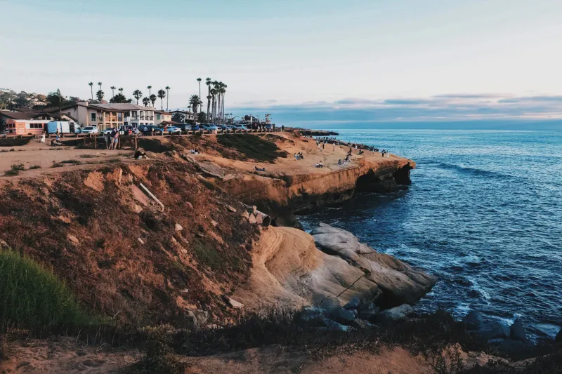
If you've visited Sunset Cliffs before, you know the scene at the main overlooks: people lined up along the railing, phones raised, everyone jockeying for the same angle on the same view. The spot is beautiful—no question—but it can also feel weirdly impersonal for a place that's supposed to deliver a moment of connection with the Pacific.
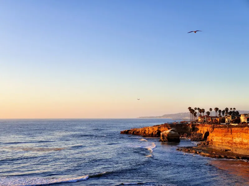
Here's the thing most first-timers don't realize: Sunset Cliffs Natural Park stretches for nearly two miles along the coastline, and the famous spots make up maybe a tenth of that distance. The rest? Quieter, less trafficked, and in some cases, genuinely more impressive.
This guide is about those places. Specific, practical, and organized by what you'll find there.
Why the Viral Spots Aren't Always the Best Spots
Social media has done something interesting to Sunset Cliffs. It's surfaced certain locations—the natural arch, the main blowhole overlook, a handful of specific rock formations—and concentrated visitor traffic in ways that didn't exist a decade ago. That's not a complaint, exactly. Attention is well-deserved. But it does mean that the most photographed spots are often the most congested, and the experience of standing there can feel more like waiting your turn than having a moment.
Locals figured this out a long time ago. They still love the park, but they've quietly shifted their routines to the less obvious corners—the stretches of cliff where you might encounter one other person instead of forty.
"Most people walk from the parking area straight to whatever spot they've seen on Instagram," says lifelong Ocean Beach resident Carmen Solís. "If you just keep walking in either direction for ten minutes, you'll find something equally beautiful with nobody around. It's that simple."
She's right. Here's where to go.
The Southern Stretch: Ladera Street to Cornish Drive
The southern end of the park—accessible from Ladera Street or by walking south from the main Sunset Cliffs Boulevard corridor—sees significantly less foot traffic than the central sections. The cliffs here are lower in some areas, which means better access to the rocky shelves at the base, and the coastline curves in ways that create interesting foreground elements for photos.
Park on Ladera Street (free, usually available even on busy days) and walk west toward the water. Follow the informal path that runs along the cliff edge heading north. You'll pass through a stretch with almost no infrastructure—no railings, no paved paths—that feels genuinely removed from the busier sections of the park.
Best time to visit: Late afternoon on weekdays, or early morning any day of the week. The lower cliff sections here allow for closer wave watching during moderate surf.
What makes it special: The angle of view looking back north along the cliffs is one of the best in the park for capturing the layered sandstone formations in profile. Most visitors only ever see the cliffs from the front. This stretch lets you see the shape of the coastline itself.
The Tide Pool Reef at Ab Cove
Nestled in the central section of the park, Ab Cove (short for abalone cove, though abalone haven't been common here for decades) is one of the most productive tide pool areas along the entire Sunset Cliffs coastline—and it's consistently less crowded than the main overlooks above it.
Access is via a steep, informal trail that descends from Sunset Cliffs Boulevard near Cornish Drive. The trail is not maintained and requires some scrambling; wear closed-toe shoes with grip. At the bottom, a series of rocky shelves extends into the water, exposing rich intertidal habitat during low tides.
Best time to visit: During minus tides, ideally in the morning when the light is coming from the east and illuminating the tide pools rather than creating glare. Check tide charts before you go—NOAA's tide prediction tool is free and reliable.
What makes it special: The perspective looking back up at the cliffs from sea level is completely different from anything you'll see from the top. The cliff faces tower above you, layered and textured, with waves crashing around the rocks. It's a view most visitors never get because most visitors never come down here.
The Unmarked Overlook North of the Natural Arch
Everyone goes to the natural arch. It's spectacular, and the photos are great. But walk about 200 feet north of the arch along the cliff edge and you'll find an unmarked overlook on a flat sandstone shelf that juts out slightly over the water. No sign. No railing. No crowd.
The view from this spot looks south back toward the arch and the sea caves, which is actually a more interesting composition than shooting the arch straight on. You get the full context of the coastline—multiple rock formations, the curve of the cliff, the open ocean beyond.
Best time to visit: Golden hour, when the low-angle light catches the sandstone and turns it amber. The southward-facing view means you're shooting with the light at your back, which makes for clean, well-lit images without fighting the sun.
What makes it special: This is one of the few spots in the park where you can photograph the arch as part of a larger landscape rather than as an isolated subject. Local photographers know it. Most visitors walk right past it.
The Northern Boundary Near Point Loma Nazarene University
The northern end of Sunset Cliffs Natural Park, near where the coastline approaches the Point Loma Nazarene University campus, is arguably the most overlooked section of the entire park. It requires a longer walk from the main parking areas—about fifteen to twenty minutes heading north from the main corridor—which is enough to filter out most casual visitors.
The cliffs here are higher and more dramatic in some sections, and the rock formations have a different character than the central park—more angular, with sharper edges where the sandstone has fractured differently. The waves hit harder here too, especially during northwest swells.
Best time to visit: Morning, when the light comes from the east and the cliff faces are in full sun. This section faces more directly west than the central park, making it excellent for sunset shooting when you want a less populated foreground.
What makes it special: On clear days, the view from the northern sections extends south along the entire Sunset Cliffs coastline, with Point Loma and the lighthouse visible in the distance. It's one of the few spots in the park that gives you a true sense of the scale of this coastline.
A Note on Getting There Safely
Some of these spots involve informal trails, uneven terrain, and areas without railings. A few practical reminders:
- Wear shoes with real grip. Flip flops are a bad idea on sandstone, especially near water.
- Don't approach cliff edges that look unstable. Sunset Cliffs sandstone erodes constantly, and edges that look solid can give way.
- Check surf conditions before going down to sea level. High surf makes the lower areas genuinely dangerous.
- Go with a buddy if you're exploring unfamiliar sections for the first time.
None of this is meant to be discouraging. It's just the reality of exploring a wild coastline rather than a manicured park. The reward for being careful and prepared is access to parts of Sunset Cliffs that feel genuinely like a discovery—even though they've been there all along, waiting for someone willing to walk a little further.